
Explorer Flight Missions: Out Of Thin Air

The month of September is TPC Charters Airline event month. For our regular Explorer flights we wanted to feature some of the event airports from that event. Please, note that you do not have to be a Member of TPC Charters Airline to fly the flights below. TPC Charters Airline Pilots, however can get extra points via Explorer for flying these fields. The below fields are part of event Wave 1 airports.
You can fly these flights on your own or get a group going - it’s up to you. Make sure you choose an appropriate aircraft and conduct proper flight planning. Let the adventure begin!
To get the Explorer server role (access to Explorers DISCORD channel) and 500 TPC Points for each flight:
Fly to or from any of the airports on this list.
Leave a comment on this post with the ICAO code of the airport you flew into. Feel free to share more details about your flight, if you’d like.
Post pics from your flight in screenshots channel on DISCORD.
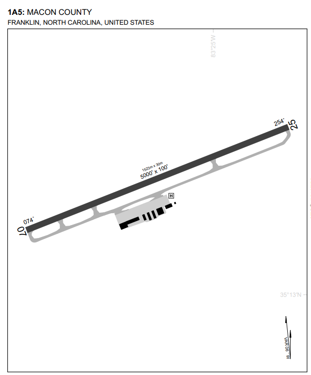
1. 1A5:
Macon County Airport.
Franklin, North Carolina, USA.
Macon County Airport (FAA LID: 1A5) is a public use airport in Macon County, North Carolina, United States. Owned by the Macon County Airport Authority, it is located three nautical miles northwest of central business district of Franklin, North Carolina, in the Valley of the Great Smoky Mountains.

2. KHDN: Yampa Valley Airport.
Hayden, Colorado, USA.
Yampa Valley Regional Airport (IATA: HDN, ICAO: KHDN, FAA LID: HDN) is in Routt County, Colorado, United States, serving the communities of Steamboat Springs, Hayden, and Craig, Colorado. The airport is two miles southeast of Hayden, about 20 miles east of Craig and about 25 miles west of Steamboat Springs. It has the only scheduled passenger flights in northwest Colorado. It is also used by larger business jets that cannot use the smaller Steamboat Springs Airport (Bob Adams Field).

3. KGWS: Glenwood Springs Municipal Airport.
Glenwood Springs, Calorado, USA.
Coordinates: N39°30.36' / W107°18.54'
Located 03 miles S of Glenwood Springs, Colorado on 33 acres of land.
Estimated Elevation is 5916 feet MSL.
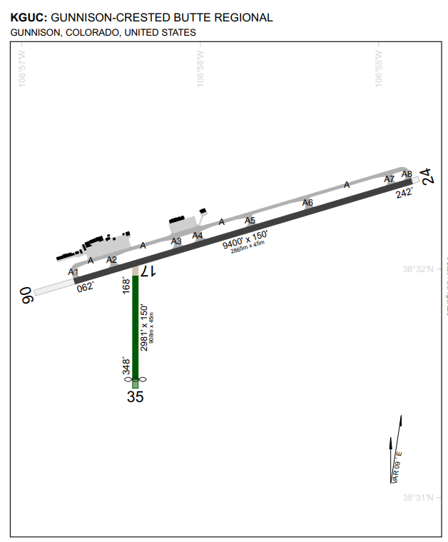
4. KGUC: Gunnison-Crested Butte Regional Airport.
Gunnison, Colorado, USA.
Gunnison–Crested Butte Regional Airport (IATA: GUC, ICAO: KGUC, FAA LID: GUC) is a county-owned, public airport one mile southwest of Gunnison, in Gunnison County, Colorado, United States. Also known as Gunnison County Airport, it serves the valley and nearby Crested Butte, Colorado, with airline and general aviation flights.

5. KLXV: Lake County Airport.
Leadville, Colorado, USA.
At an elevation of 9,934 ft (3,026 m) above mean sea level the airport claims the distinction of being North America's highest.
Pilots receive a free certificate commemorating their landing upon a successful landing. Aircraft performance deteriorates rapidly with altitude, so many organizations use the Leadville Airport as a base for high-altitude performance testing.


